After reaching Land's End we spent a few hours enjoying the attractions, including 4D cinema and the comfort of the Land's End Hotel where we signed the guest book to formally record our journey. We also took time to walk around to Sennen again and visit the First and Last pub in England, complete with smuggler's tunnel which we had skipped the previous day. On returning to the hotel, we were greeted by an amazing sunset that provided an opportunity to get some good photos by the signpost without the masses of tourists.
The following day it felt strange to be getting up at a normal time, enjoying a good breakfast and not having to walk 25 Miles. Instead, we had to endure a dreadfully overcrowded 5 hour train journey back to London from Penzance. From there it was another train journey back to Milton Keynes and a final taxi leg where I got the driver to drop me off early so that I could walk the final half a mile home. And so the long journey ended and it was back to the world of clean clothes, home cooking, daily chores and the day job.
On reflection, it still doesn't seem possible that we walked all that way. Tim lost one and a half Stones and I lost half a stone which I put on again after just one week of having an insatiable appetite. I found that none of my shoes fitted me when I got home, my feet had gone up by a whole size! The blisters have now disappeared leaving the soles of my feet feeling like shoe leather and I have a numb section of thigh that came on in the first week of the journey and still hasn't returned to normal.
Would I do it again? Yes, of course, I'd love to, although at a slower pace, in fact I'd have liked to have carried on from Land's End and walked around the South West Coastal Path. I'm not sure that I will ever get the opportunity to be away from home and work for such a long period of time again though, so for now it is just nice to know that I have done it and to look back at my leisure on all the amazing bits.
Best Bit
There were many good bits, almost every day had parts that I would like to go back to, but my favourite bit was the stretch of the South West Coastal Path from Helston to Penzance on the penultimate day. Maybe it was because we had been away from the sea for so long, or that we were just so used to the walking by then that everything felt good, or maybe just that the end was in sight. Whatever the reason, it was my favourite bit.
Worst Bit
Reaching Land's End was a complete let down for me. The realisation that it was all over combined with the masses of people made the ending feel very dull.
Long hot days walking along boring canals with painful blisters will also be an enduring bad memory.

Thursday, 22 August 2013
Friday, 9 August 2013
Day 49 - Penzance to Land's End - 12 Miles
We made it!
Yes, at around 1pm on Friday 9th August, after 49 days and 1,185 Miles we finally reached Land's End. There was no rush this morning, with only 12 Miles to cover, we had time to enjoy a full breakfast. No need to stop and pick up extra food and drinks, just straight off into the morning sun, navigating our way along the final remaining roads between Penzance and Land's End. As we neared Sennen, we had no choice but to walk a stretch of the A30, giving reminders of how this journey started seven weeks ago on the A99. We had planned to stop at the First and Last Inn in England as we approached Land's End, but as it was still early we were fairly sure that it would be shut, so we decided to forget the First and Last Inn and its busy location and take the scenic route via Sennen Cove. The decision was a good one and we took time to stop for lunch at the beautiful Sennen Cove before heading off for the final 1.5 Miles along the coastal path to Land's End.
The final mile and a half was a busy multi-cultural procession along the coast until in front of us appeared the iconic signpost, with accompanying crowd and queue of people waiting to have a personalised photo taken. We duly queued up and had our moment captured for a small fee.
My feelings on reaching the end were mainly anti-climax, the whole heaving tourist spot that Land's End now is doesn't seem to fit with everything that has passed in the last 49 days and undelines more than ever that this has been about the journey and not the end. We checked into the excellent Land's End Hotel and signed the End to Enders guest book. A quick scan of which confirmed that people have indeed been walking in the other direction in last few months, but we failed to bump into any of them.
The impact of what we have done has not sunk in yet for me, but I am proud that we have both made it through. As for a reason why we did it in the first place, I have had plenty of time to consider the answer over the last 49 days, and the best answer for me came from a conversation in the Saloon in Stonehaugh that went as follows:
Bar man picks up a guitar and plays a few songs.
Pennine walker sitting at the bar says "That's one thing I always wish I'd learnt to do, play guitar"
"You're not dead yet are you?", says a man in the corner with an accordion.
"I think I will learn when I get back", says the Pennine walker.
That summed it up for me, I don't need any other reason than that I wanted to do it and I'm not dead yet.
Finally, I would like to thank everyone for all the emails, texts of support and donations to charity, all of which have helped us to keep going when times were hard (and there were many) and it would have been easier to stop.

We did it!

Tourists gone and a few drinks later.
Distance: 11.3 Miles
Moving Time: 3 Hours 31 Mins
Cumulative Distance: 1,139.14 Miles
View the route for day 49 here.
Thursday, 8 August 2013
Day 48 - Helston to Penzance - 18 Miles
'West Highland Way?'
'Great Glen Way?'
'Pennine Way?'
'Cotswold Way?'
'Great Glen Way?'
'Pennine Way?'
'Cotswold Way?'
This is what people have been asking us over the last seven weeks ask as we pass them by. Today it was 'Coastal Path?' and I felt very smug in being able to reply with 'John o'Groats to Land's End, day 48', the reply is invariably 'well done! Nearly there now'.
For me, today felt like walking on air as we took the coastal path from Helston, passing through Porthleven, and when we stopped at Pra Sands for coffee I couldn't believe that we'd done 9 Miles already. The coastal path was fantastic, the hills didn't register any pain, the feet were not hurting and the whole 18 Miles to Penzance felt like a Mo Farah lap of honour at the Olympics.
Our accommodation for the night is a shared room in the Youth Hostel with some guys who are currently serving in the military and know all about Leukotape and foot pain. One of the guys said that he had to carry a 50kg pack once! I reckon mine must be down to 10kg now.
Land's End tomorrow and I'm going to enjoy every last second of it.
St Michael's Mount.
Statistics
Distance: 18.3 Miles
Moving Time: 5 Hours 47 Mins
Wednesday, 7 August 2013
Day 47 - Truro to Helston - 21 Miles
With just three days to go now and all the big mileage days out of the way, it's time to enjoy the walking and make the most of the remainder of this journey. The weather was good today as we headed out of Truro, following Sustrans route 3 to Perranwell. Most of the footpaths round here seem to be overgrown and impassable, so the rest of the day was spent following lanes through small villages, Stithians, Carnkie, Porkellis, Trenear, passing by reminders of Cornwall's once thriving mining industry.
The 21 miles to passed pretty quickly and by mid afternoon we arrived at Helston, home of the 'Furry dance' we are informed upon entering. We stopped at the Blue Anchor for a pint of Springle as advised by the landlord last night. Apparently, the Blue Anchor is the oldest brewery in Cornwall. We have now visited the highest Inn in Britain, the highest pub in Cornwall, the oldest brewery in Cornwall and on Friday we will stop in the first and last pub in England.

Cornwall is a beautiful place when the weather is like this.
Statistics
Distance: 21 Miles
Moving Time: 6 Hours 23 Mins
Tuesday, 6 August 2013
Day 46 - Tredethy to Truro - 33 Miles
Another day starting in wet boots and damp socks, oh well never mind, at least the rain has stopped and we're past Bodmin Moor. Still a big day to get through though, starting with 8 Miles of unfinished business from yesterday. We knew today was going to be a long day, but its not too bad when following little lanes, frequently crossing the A30, constantly reminding us that there is a more direct alternative available should we wish to take it. I don't care though, I have no intention of finishing this walk in the manner we started on the A9. In fact we have been able to decide exactly how we want the final few days to be, deciding to book all accommodation in advance and finish with an easy 10 Mile roll in to Land's End on Friday.
Having booked ahead, there is no longer any need to carry the camping gear around any more, so seeing as gramms are our currency, the surplus gear got binned at the first opportunity and our packs are now lovely and light, a real luxury for the last few days.
With such a high mileage to cover we were keen to keep moving today. However, we didn't count on having to deal with the farm dog that decided to start following us. We just couldn't get rid of it. No matter what we tried it wouldn't go away and followed us for three miles before we started getting really annoyed with it. We even tried crossing a big stile into a field and blocking it with our packs, but the thing was over before we could stop it. Eventually, we had to phone the number on its collar and get its owner to come and retrieve it so we could carry on our way, otherwise I'm sure that it would have followed us all the way to Land's End.
So, the longest mileage day of the trip is over, our feet have borne the brunt, but we're not bothered. We celebrted with a few drinks in the bar and got some more donations from some friendly locals and the landlord. We are going to enjoy the final few days of this journey as much as possible.

A nice, but long day on Cornish lanes.

The dog that wanted to walk to Land's End.
Statistics
Distance: 32.8 Miles
Moving Time: 11 Hours 36 Mins
Monday, 5 August 2013
Day 45 - Launceston to Tredethy - 25 Miles
Oh my god, what an awful day! What a crazy idea to try and walk across Bodmin Moor on a day like this. From the moment we set off it was chucking it down, but I was quite well cocooned and dry inside my new waterproof top and trousers. So the first 10 Miles out of Launceston passed quite swiftly, following very quiet roads, then we turned onto the moor. From then on, it was a case of battling against mossy rocks, large grassy mounds, gorse, fern and worst of all marshy bog and streams. I soon ripped a hole in my waterproof trousers crossing a barbed wire fence which let water flood into my boot, but there was no point in trying to stay dry anyway as the scrambling through the moor saw us both frequently sinking up to our knees in marshy bog whilst trying to cross streams. Navigation was difficult, trying to keep on track using the GPS to guide us in the driving rain, without it we'd have been in trouble, thank goodness it is waterproof.
After what seemed like an eternity we made it to the other side of Bodmin Moor feeling totally exhausted. Once back on proper roads, good progress was resumed, but we had to stop to wring brown bog water out of our socks.
One thing we have learned all too well on this trip is that long distances on wet feet cause blisters, so not wanting to cause any unnecessary damage we took a shortcut past St Breward, then joined the Camel Trail (an old railway line named after the river Camel) and checked into some accommodation a few miles short of Bodmin.
Thank god we don't have to cross any more moors!

The only picture we managed to take after crossing Bodmin Moor.
Statistics
Distance: 24.6 Miles
Moving Time: 8 Hours 23 Mins
Sunday, 4 August 2013
Day 44 - Okehampton to Launceston - 24 Miles
What a difference a day makes, after yesterday's perfect weather and easy going along quiet lanes, today we got a full drenching and were back to struggling to get the navigation right. The day started off dry as we left Okehampton Youth Hostel behind and picked up the Two Castles Trail that links Okehampton and Launceston. Then, one missed turn saw us at the bottom of a viaduct we needed to be crossing over and caused us a costly diversion via the Meldon reservoir to get back on track. At this point the rain began and persisted all the way to Launceston, making the remainder of the walk a bit miserable. However, we did reach the milestone of passing into Cornwall as we crossed the river Tamar just outside Launceston.
I have read several accounts of Launceston and not found a good word to be said about it by anyone, so my expectations were not high as we approached the town, set at the top of a steep hill with a castle visible at the top. The place didn't seem that bad to me, even though the weather was bad and everything was shut as it was late Sunday afternoon. There seems to be a Polish community here, judging by some of the restaurants on the high street and Eastern European sounding people in the only shop we found open. For me, I'll say that Launceston is ok, because our accommodation is great and we're not staying here long enough to put it down.
We gained another day today, but we're not congratulating ourselves, because we could easily lose it again tomorrow if we don't get things right. With 30 odd miles to cover over Bodmin Moor and a weather forecast to make your heart sink, it's fair to say that we need to get everything right. Food, navigation, feet, wet weather clothing all need to be right otherwise we'll be camped out on the Moor for the night. Yes, tomorrow is our Beeches Brook, once we are over that, there will be no big obstacles remaining on the way to Land's End.

Just Cornwall to walk through now.
Statistics
Distance: 23.8 Miles
Moving Time: 8 Hours 12 Mins
Saturday, 3 August 2013
Day 43 - Crediton to Okehampton - 21 Miles
I've definitely had it with Compeed now. Sure, they protect your blister from the friction of the boot whilst walking, but you need to cover them with tape to stop them moving or sticking to your sock like glue, but the worst thing is that when you try to remove them at the end of the day, they have stuck to your skin so strongly that pulling them off removes the skin from the blister as well, and that hurts. So instead, today, after spending a night worrying about if I was going to be able to make it through today and how many Nurofen I have got left, I decided to just put a non sticky bit of plaster over the blister and tape it down well.
I set off pretty gingerly for the first few miles, but soon I'd forgotten all about it and just got on with the walking. Taking it off again at the end of the day was also a breeze, so Compeed is now history.
The walk today also turned out to be one of the best of the trip so far. Leaving Crediton behind, we wove a route through minor lanes in a generally Westerly direction. With all the traffic drawn off to the A30, the lanes were as quiet as anything we have experienced since the Scottish Borders region, with only the local postal van making an occasional appearance. With the weather much cooler and no stile hopping to slow us down, the 21 Miles to Okehampton flew by, passing picturesque villages like Yeoford and Spreyton where we stopped for coffee, it was a really nice day, we enjoyed it so much that the significance of passing the 1000 Mile point completely passed us by.
Accommodation for tonight is Okehampton Youth Hostel, which is fine. We were seriously considering ditching the tents at this stage, but with a brutal 35 Mile day across Bodmin Moor looming, I think we'll keep them a bit longer.

Yeoford in the morning.
Statistics
Distance: 20.4 Miles
Moving Time: 6 Hours 52 Mins
Friday, 2 August 2013
Day 42 - Tiverton to Crediton - 17 Miles
After the previous few days high mileage, I was in need of a rest. My feet have come out in some new blisters, making things painful, so it made sense to check into some good accommodation in Crediton and rest up, rather than push on trying to gain more time.
The day had started well, with the nice lady at the B&B dropping us off at the point where she had picked us up yesterday when we were struggling to find the address. We then followed a river trail to Bickleigh Mill and Castle, before heading towards Crediton along some steep, but quiet typical Devon country lanes.
Once checked in at Crediton, I took a bit of time to read the blog of the guy who's route we have been following since Glasgow and it makes very interesting reading. He was doing the journey South-North and at this point in the walk he tells a very similar tale to our journey through Scotland, with blisters, swollen shins, limps and compeed stuck to his feet in a congealed mess. Maybe everyone has to go through this pain, or maybe as the man operating the signpost at John o'Groats pointed out, "most people take three months to walk it, not seven weeks!"

The only thing that has got heavier as we go on is the medical kit. All this is needed to get our feet through each day.
Statistics
Distance: 16.9 Miles
Moving Time: 5 Hours 42 Mins
Thursday, 1 August 2013
Day 41 - Taunton to Tiverton - 28 Miles
I said that I wasn't going to complain about the weather again in this blog, and I won't, but oh my god it was hot today! At one point we had to knock on someone's door to ask for water. Fortunately the nice lady that answered was happy to fill our bottles with water and ice.
The route was nice enough, following initially the Taunton to Bridgewater canal, then onto the West Deane Way, which was considerably better maintained than its sibling, the East Deane Way, that we followed yesterday. There were some lovely wooded sections that provided shade from the burning sun, and none of the busy roads of yesterday. The rest of the walk followed the Great Western Canal which is interesting for a few reasons; it was designed to link up with the Taunton to Bridgewater canal, but was never completed, also, it is the only canal that I have ever seen where the water is clear enough to see the bottom and finally; it is being actively maintained which we noted as we passed a section that had been drained and dug out.
The Great Western canal terminates in Tiverton and Tiverton is in Devon and Devon really feels like we are getting there.
The lady in at our B&B this evening asked us if we had seen a man with a staff who looked like a Pilgrim heading to John o'Groats. We hadn't, but we had been mistaken for Pilgrims ourselves by a Swiss cyclist in Scotland. Surely it won't be long now before we bump into one of these people.

Great B&B we stayed at tonight.
Statistics
Distance: 27.8 Miles
Moving Time: 8 Hours 57 Mins
Wednesday, 31 July 2013
Day 40 - Glastonbury to Taunton - 25 Miles
If ever a day felt like a filler, this was it. Ever since Inverness, we have had the luxury of being able to follow long distance footpaths or canals, linking up nicely all the way to Somerset, but today this ran out, leaving the option of either following direct A roads, or weave a path through minor roads and footpaths. The day started well enough, with paths alongside the main road out of Glastonbury and on to Street, where it promptly ran out. Continuing along it without a footpath or verge would have been suicidal, so we rerouted onto Kings Sedge Moor, zig zagging along quieter lanes in more or less a Westerly direction.
It seems that every day we meet more people interested in what we are doing and it was whilst we were weaving our way through Kings Sedge Moor that we met a nice couple who informed us that we were very close to a H4H rehabilitation centre. If we had had more time, we could have popped in, but as usual we were desperately trying to reach our destination, with the mileage getting higher with every detour to avoid the main roads.
Eventually we picked up on a direct route following some drainage canals called the East Deane Way which was a bit overgrown in places, but better than being on the roads. This linked into the largely disused Taunton to Bridgewater Canal which brought us to our final destination for the day. The final mileage was 6 Miles more than if we had followed the A road out of Glastonbury. A frustrating addition, but all part of ensuring we get there in one piece.

The East Deane Way.
Statistics
Distance: 25.2 Miles
Moving Time: 7 Hours 49 Mins
Tuesday, 30 July 2013
Day 39 - Bath to Glastonbury - 33 Miles
We gained another day today. The planned stopping point had been the quaintly named 'Midsomer Norton', but at just 11 Miles, there was no way we could pass off the opportunity to do a double day and try to get to Glastonbury. It wasn't easy though, anything over 20 Miles gets hard, but we pushed on through the persistent rain and made pretty good going along Sustrans routes, disused railway lines and fairly quiet country lanes. At one point along the way, a cyclist who was linterested in what we were doing pointed out that we were passing a 6000 year old Long Barrow burial chamber and a car driver slowed for a chat near Glastonbury and told us that the road on which we were walking at Queens Sedge Moor was 2 Miles long and completely straight and flat. We had actually noticed this.
Glastonbury Tor can be seen from at least 10 Miles away as you approach and looks rather like a child's sand castle with a flag stuck in the top. Glastonbury itself lived up to expectations as a hippy magnet, with lots of people stranger than us walking around and the high street full of shops catering for their attire. It is a shame we don't have more time to spend here, I would have liked to have gone up the Tor, or visited the church that was offering 'Healing by appointment', to fix my feet, tired after our longest day so far.
Glastonbury Tor can be seen from at least 10 Miles away as you approach and looks rather like a child's sand castle with a flag stuck in the top. Glastonbury itself lived up to expectations as a hippy magnet, with lots of people stranger than us walking around and the high street full of shops catering for their attire. It is a shame we don't have more time to spend here, I would have liked to have gone up the Tor, or visited the church that was offering 'Healing by appointment', to fix my feet, tired after our longest day so far.

Approaching Glastonbury with the Tor visible in the distance.
Statistics
Distance: 30.5 Miles
Moving Time: 10 Hours 13 Mins
Monday, 29 July 2013
Day 38 - Chipping Sodbury to Bath - 21 Miles
Aside from the first day at John o'Groats, we have not met anyone else doing the end to end walk, be it North South, or South North. We have spoken to lots of other people who have met other people doing it. One chap we met in the Saloon in Stonehaugh said that he had met five people already doing it whilst walking the Pennine Way, including one person doing it with a banjo in his back! I think that a banjo would be the last thing I would want strapped to the back of my rucksack. I did see on the news that a man had just finished at Land's End after having danced all the way whilst wearing a tutu! And I thought that we stood out as odd.
I think that we finished with the Cotswold Way today as we completed the relatively short leg into Bath. I quite liked the Cotswold Way, despite it being pretty hard going and getting caught in some torrential downpours. Bath is also a nice place and we visited the town centre to get some new waterproofs, before heading off to the Youth Hostel which is slightly out of town, hidden away in the hillside. I wonder if anyone else staying here is doing the end to end.
I think that we finished with the Cotswold Way today as we completed the relatively short leg into Bath. I quite liked the Cotswold Way, despite it being pretty hard going and getting caught in some torrential downpours. Bath is also a nice place and we visited the town centre to get some new waterproofs, before heading off to the Youth Hostel which is slightly out of town, hidden away in the hillside. I wonder if anyone else staying here is doing the end to end.

Heading off on the Cotswold Way for the last time.
Statistics
Distance: 19.5 Miles
Moving Time: 6 Hours 47 Mins
Sunday, 28 July 2013
Day 37 - Stroud to Chipping Sodbury - 25 Miles
Our B&B for the night had been an interesting place, with walls completely covered with pictures of 60's rock stars, I half expected the owner to be playing Hendrix as we departed this morning. He was a nice chap and we said goodbye and headed off down the same two miles of road that we had already walked twice yesterday.
We were soon back onto the Cotswold Way, which was very hard going, but a nice change from the holiday home populated banks of the Severn Way. As we stopped at one of the many hilltop monuments that the Cotswold Way takes you up, we were ambushed by an over friendly horse that took a close interest in our rucksacks and nearly made off with Tim's socks hanging from the back of his rucksack!
Having survived the horse attack, our final days destination was a choice of either Little Sodbury, Chipping Sodbury or Old Sodbury. The choice was made for us as we could only get accommodation in Chipping Sodbury, or Sodding Chipbury as the locals call it. Jokes aside, The Bell turned out to be a great place to stay and the Cotswold Way hasn't been half as bad as I was expecting.

Tim had to fend off the affections if this horse, which nearly made off with his socks!
Statistics
Distance: 24.8 Miles
Moving Time: 8 Hours 29 Mins
Saturday, 27 July 2013
Day 36 - Tewkesbury to Stroud - 30 Miles
I finally lost patience with my phone today and bought a new one as we passed through Gloucester. I now look forward to being able to take photos again and I will make extra sure not to get it wet.
Glocester was a lively place, there was a wedding going on in the town centre with lots if music and dancing. However, we couldn't stay around for long as we needed to cover a lot of miles. We had previously left behind the river Severn which had been our companion for the last few days and we have now picked up the Cotswold Way. The Cotswold Way has a bad reputation as a long distance footpath because it is designed to take in every hill and point of interest, rather than just getting from A to B, so we will need to check the route very carefully to make sure that we don't go on any unnecessary detours.
We didn't quite miss the rain today, it quickly blew in as we arrived at Kings Stanley and by the time we had walked back two miles in the direction we had just come to get to the only available B&B, we were drenched. Thankfully my new phone was dry, still boxed and bagged inside my rucksack.
I won't mention my phone again...unless it breaks.
One walker for sale, high mileage, needs attention.
Statistics
Distance: 29.9 Miles
Moving Time: 9 Hours 21 Mins
Friday, 26 July 2013
Day 35 - Holt Fleet to Tewksbury - 28 Miles
My phone was on thin ice today. It refused to turn on all the way to Worcester as we attempted to follow the Severn Way, before realising that the path had mysteriously switched to the other side of the river, with no bridges for miles, causing us some navigation stress and a hasty reroute into Worcester. When we got to Worcester (which seems like really nice place), I popped into Phones 4 U to sort a replacement, but the model I wanted was out of stock, so I tried my phone again and it miraculously worked. Will it make it to Land's End I wonder before I lose patience with it and put my size 12 boot on it.
The rest of the walk today was pretty simple, follow the river, stay cool, keep drinking and make it to Tewksbury to gain another day. Simple, except that the Severn Way is occasionally blocked by private land which neccessitates big detours and the way is regularly overgrown with thistles and nettles , adding further sting to sunburnt legs.
Eventually we reached Tewkesbury and thus gained a fourth day. This is significant because it now means we only need to stick to the remaining schedule to ensure reaching Land's End on the glorious 12th August. Then back to work the following day!

First sight of Tewksbury from the Severn Way.
Statistics
Distance: 26.5 Miles
Moving Time: 8 Hours 40 Mins
Day 34 - Bobbington to Holt Fleet - 24 Miles
I have just discovered something worse than a wet phone, a wet sleeping bag. It has been sat in the bottom of my rucksack for two days unnoticed and now that I need to use it, it is damp and not likely to dry very quickly. The thing has been rubbish from day one as it has been leaking duck feathers into my tent at an alarming rate, but it has at least been warm and comfortable, when dry.
Today's walk turned out to be a nice one, the first ten miles were on quiet country lanes, before we picked up the Severn Way, following the banks of the river Severn, with the Severn Valley steam railway to our left. We followed this to Bewdley, which felt like a seaside town, then continued along the river passing lots of holiday homes on the river front, some immaculately maintained, some in total disrepair. Our final destination was one of the many campsites along the way, making a convenient stopping point, well ahead of our planned stop.
A quick addition of our mileage shows that we have covered around 785 Miles, averaging 23 Miles a day. That puts us 75% of the way to Land's End.

Strimmer anyone?
Statistics
Distance: 24.1 Miles
Moving Time: 7 Hours 37 Mins
Wednesday, 24 July 2013
Day 33 - Penkridge to Bobbington - 22 Miles
It looks like the rain of yesterday may well have killed my phone completely, threatening to hamper our navigation, stop me taking any photos, Skype home and indeed keep this blog going. There was no sign of any rain today, in fact the conditions were pretty much perfect for walking, which is more than can be said for the roads, which were in comfortably busy, so at the first opportunity we re-routed onto the Staffs to Worcs canal. The decision was a good one and we followed the canal right through the centre of Wolverhampton (although you wouldn't have noticed it) and out the other side. We exited the canal near Seisdon and stopped for a drink at The Old Gate in Heathton where the landlord would take no money for our drinks and said to give the money to charity, which I promptly did.
Our final destination was the Red Lion in Bobbington, which turned out to be a fantastic place, in such a small town and had a great stuffed lion and tiger in the bar, which were apparently family heirlooms.
More rain on the way tomorrow, better keep the phone well protected this time.
Our final destination was the Red Lion in Bobbington, which turned out to be a fantastic place, in such a small town and had a great stuffed lion and tiger in the bar, which were apparently family heirlooms.
More rain on the way tomorrow, better keep the phone well protected this time.

The Staffordshire to Worcestershire canal.
Statistics
Distance: 20.8 Miles
Moving Time: 6 Hours 28 Mins
Tuesday, 23 July 2013
Day 32 - Uttoxeter to Penkridge - 28 Miles
OK, so we got both the sex and hair colour of the royal baby wrong, but we did get one thing right today, full wet weather gear. Yes, the waterproof trousers I have been waiting to use were definitely required today as we set off into the heavy rain and bolts of lightning this morning. The waterproof trousers were also very useful for barging a path through the massively overgrown sections of the Staffordshire Way that we encountered. Unfortunately, the rest of my gear didn't perform so well, my boots are letting in water, I'm not at all sure if they will see me to Land's End and my waterproof top leaks so much water that my phone got soaked and stopped working, so no camera for most of the day.
By midday, the rain had cleared and the difficult sections of the Staffs Way were replaced by a nice section of the Staffordshire to Worcester Canal, then onto the grounds of Shugborough Hall. The Staffs Way then takes you on a mad stretch of the A51, before entering Cannock Chase Park which involved navigating a maze of paths criss crossing the pleasant woodland. A final stroll along the canal brought us into Penkridge, our destination for the day.
Tim thinks the royal baby will be called Richard, and I think John.

Don't mind the rain, could do without the lightning.
Statistics
Distance: 26.9 Miles
Moving Time: 9 Hours 01 Mins
Monday, 22 July 2013
Day 31 - Ilam Hall to Uttoxeter - 17 Miles
Apparently Ilam is historically famous for having contracted the plague from contaminated cotton and the residents who died became martyrs for not leaving the village and containing the outbreak (edit: this story is rubbish thanks to a Tim mispronunciation!). Ilam Hall itself turned out to be a good place to stay, well organised with pretty much everything you need, at a good price. No wonder then that the only other hotel in the area was derelict, overgrown with weeds and out of business. The same could also be said for the section of the Limestone Way that we attempted to navigate at the start of the walk today. Progress was very slow, crossing endless farmer's fields and trying to locate well hidden styles on the other side. Eventually we switched to the Staffordshire Way which seemed to be a little better maintained.
The Staffs Way brought us right into Uttoxeter, next to the Race Course. I didn't know what to expect from Uttoxeter, but it turned out to be a nice place, so we checked into a local (supposedly haunted) hotel, complete with unexplained hooks in the ceiling.
By the time we leave tomorrow, there should be a new royal baby, I think it will be a girl, and Tim thinks it will be ginger.

Which way now? On the Limestone Way.
Statistics
Distance: 16.6 Miles
Moving Time: 5 Hours 52 Mins
Day 30 - Castleton to Ilam Hall - 30 Miles
It doesn't seem like 2 minutes since I was having my photo taken against the Pennine Way signpost that marked our entry into England, before all of a sudden, without even realising it yesterday, as we arrived at Edale, we had finished the thing. There was no big start/finish line, or anything to indicate that our companion for the last 9 days had come to an end.
So as we left Castleton this morning and it dawned on us that we had just completed probably 80% of the Pennine Way, we picked up the new trail that will be our friend now, the Limestone Way. Marked with white rams heads instead of acorns, the difference was immediate. As soon as we completed the climb out of Castleton, the terrain became much less steep and we were able to cover ground much more quickly. By mid day we reached Monyash where the roads got a bit busy, so we rerouted onto some quiet footpaths before reaching the Dovedale Trail. This popular river trail passes by caves and rocky stacks that must make for some great rock climbing.
Finally we ended the day with the usual search for accommodation and were mightily relieved to get a room at Ilam Hall youth hostel. I haven't stayed here since 1984, but the place is still going strong and a great place to stay.

Impressive stacks along the Dovedale Trail.
Statistics
Distance: 28.3 Miles
Moving Time: 9 Hours 47 Mins
Saturday, 20 July 2013
Day 29 - Snake Pass to Castleton - 13 Miles
Between Padfield and Edale lies approximately 20 Miles of nothing but moors and hills, certainly no hostels or campsites, we therefore spent a very comfortable night hidden from view near to Snake Pass. We weren't the only ones to do it either and with an ethic of take only photographs, leave only footprints, you wouldn't have known we had been there. What a shame the English laws on rough camping do not mirror those of Scotland.
After having made such good progress yesterday, it didn't take long to cover the 14 Miles to Castleton, via Kinder Scout and Edale. However, we were both pretty depleted due to not having eaten properly for a few days, so we found ourselves a B&B to recoup for a bit, happy in the knowledge that we have now gained a third day on our schedule.
Whilst watching the BBC news from the comfort of the room, on the day that Mel Smith died, I watched a short documentary about Yemeni refugees trying to reach Saudi Arabia to find well paid work and better themselves. The majority of them do not make it and end up tortured, robbed and worse and are lucky if they make it back home alive. It really puts our little adventure into perspective when the biggest problem we encounter is trying to find a pub that serves cold beer every day. In light of this, I will no longer complain about; the weather (although I may comment on it), blisters, the distance we have to walk or the quality of the accommodation. All these are a million miles away from what some people go through and whose stories are never told.
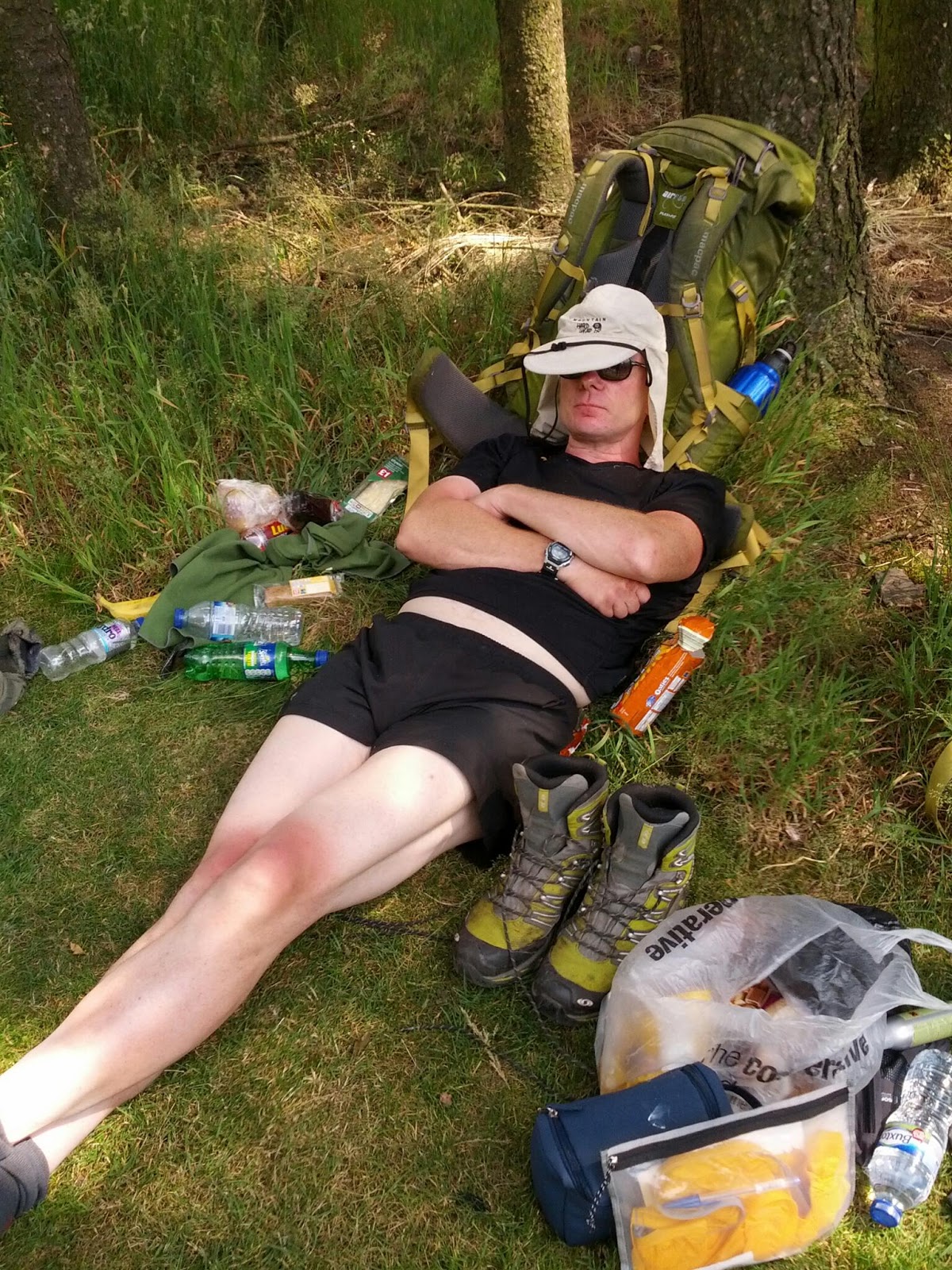
.jpg)
The 'Pennine Way walker's look', tired, dishevelled and in need of a shower.
.jpg)
Statistics
Distance: 13.3 Miles
Moving Time: 5 Hours 13 Mins
Day 28 - Diggle to Snake Pass - 23 Miles
Leaving Diggle behind this morning felt like quite a relief. The accommodation had been noisy and chaotic, with the room next door being used as a kennel by the owners. However, they did at least remember to leave our packed lunches by the door so that we could get away early.
We are into the Derbyshire Peak District now and it feels just as remote as parts of Scotland. We saw no-one at all for 4-5 hours, then just a few people coming the other way as we descend into Crowden at lunch time. There is a nice little campsite at Crowden where we rested for a few hours and stocked up from the shop. Not wanting to repeat the mistakes of the Diggle diversion, we decided to wait around at the campsite until it was a bit cooler, then head off into the hills again, bypassing Padfield where we had originally planned to stay. The move was a good one and we made good progress in the cooler afternoon and ended the day near the Snake Pass crossing.
We are into the Derbyshire Peak District now and it feels just as remote as parts of Scotland. We saw no-one at all for 4-5 hours, then just a few people coming the other way as we descend into Crowden at lunch time. There is a nice little campsite at Crowden where we rested for a few hours and stocked up from the shop. Not wanting to repeat the mistakes of the Diggle diversion, we decided to wait around at the campsite until it was a bit cooler, then head off into the hills again, bypassing Padfield where we had originally planned to stay. The move was a good one and we made good progress in the cooler afternoon and ended the day near the Snake Pass crossing.
Siesta at the friendly Crowden campsite.

and baking at the top of the peaks as well!
Statistics
Distance: 21.7 Miles
Moving Time: 8 Hours 42 Mins
Thursday, 18 July 2013
Day 27 - Hebden Bridge to Diggle - 19 Miles
It pays to take a closer look at the following days route over a pint the night before, as it turned out that there is a canal that runs between Hebden Bridge and Little borough that seemed to be an obvious alternative to heading up and onto the ridge at the start of the day. We decided to take the canal route and it turned out to be a good choice that saved us a few hours of climbing. When we did leave the canal at the Pennine bridleway just before Little borough, the climbing began immediately and continued until we reached the 600 year old 'Aggin Stone' way marker, complete with informative plaque asking for the stone to be respected. There was however, no plaque to explain how the adjacent 'Dick Slack' marked on the map came to be named.
The remainder of today's route continued over the tops of the moors, before crossing the exposed M62 via a pedestrian bridge built specially to prevent Pennine Way walkers attempting a suicidal crossing of the motorway. Immediately after crossing the bridge and before entering the infamous Saddleworth Moor, we arrived at a roadside tea stop, the owner of which informed us that he had been serving teas and food to weary walkers for the last 35 years, only taking Christmas Day off and that he features in Wainwright books, and a Doves video amongst other things. I had in fact heard of this guy from reading Mark Moxon's book, so it was good to meet him and the refreshments were very welcome seeing as the only other pub on the route today had its doors firmly locked until 12.
The final destination today was Diggle, which meant a descent off the hillside, then a further 2 Mile walk into a very underwhelming town centre to get some food. With hindsight, it would have been better to have stocked up from the 35 year tea man and stayed on the ridge for a rough camp. Hindsight is a wonderful thing.

The Rochdale canal leaving Hebden Bridge. The highest canal in England.
Statistics
Distance: 19 Miles
Moving Time: 6 Hours 42 Mins
Wednesday, 17 July 2013
Day 26 - Skipton to Hebden Bridge - 23 Miles
Skipton was shrouded in mist this morning as we set off and as soon as we re-joined the Pennine Way, the climbing started and continued steeply until we eventually got a view looking back into the valley to see the whole of Skipton enveloped beneath the clouds.
We had started the day with only the Travelodge takeaway breakfast offerings to fuel us up, hoping to pass somewhere along the way to get a decent lunch. However, there were no shops en-route, so we did the 23 Miles to Hebden Bridge on minimal food, which was not ideal.
Even though the walking was tough, there were some nice parts along the way, Stanbury Moor was great, and later we passed the ominously named 'Midge Hole', but didn't pay it a visit.
Hebden Bridge turned out to be a nice place, buzzing in the heat wave, with plenty of bars, cafés and shops. Apparently, Hebden Bridge was completely flooded out this time last year, no sign of that today on the hottest day of the year so far.

One of the many paved sections of the moor.
Statistics
Distance: 22.7 Miles
Moving Time: 8 Hours 13 Mins
Tuesday, 16 July 2013
Day 25 - Horton-in-Ribblesdale to Skipton - 24 Miles
What a scorcher! Hot, humid and no wind. All this made the 24 Miles today really uncomfortable and the early start didn't help much either, so instead of a nice walk, mentally adding up whether we had passed the half way point yet or not (we hadn't), all we could do was try to keep cool. We were not short of water, experience has taught us to start each day with a full 1.5 Litres and buy more bottles along the way whenever possible, but the Pennine Way had us really sweating. The nicest part was the river section shortly after Kirkby Malham which was cool and flat.
We reached Skipton right in the heat of the early afternoon. Skipton is a big touristy place, with a canal running through the centre of town. With no campsite or hostel and all the B&Bs' fully booked we were lucky to find space at the Travelodge, but it was a mile back in the direction we had already walked and they insisted we booked online, which was unbelievably painful to do on a mobile phone.
With the weather set to be marginally cooler tomorrow, things can only get better.

A very pleasant section of the Pennine Way.
Statistics
Distance: 23.6 Miles
Moving Time: 7 Hours 45 Mins
Monday, 15 July 2013
Day 24 - Stonesdale to Horton-in-Ribblesdale - 29 Miles
It may seem a bit strange to be buying waterproof trousers in a heat wave, but that's exactly what I did today in Hawes, much to the amusement of the shop owner, "expecting rain?" he said, totally unaware of the length of the journey I was undertaking. He also sniggered at me buying Compeed plasters, but this was the first chance I've had since the drenching in Scotland to visit an outdoor shop. Suitably re-equiped for the inevitable end of the British summer, we headed off. We successfully side stepped Great Shunner Fell by sticking to some quiet roads that skirted the summit. This policy would allow us to gain another day if we could make it to Horton-in-Ribblesdale today. As we reached the Ribblehead viaduct, I was for once on roads that I knew, having competed in the 3-Peaks cyclo-cross race more timed than I care to remember. We eventually reached our destination at the base of Pen-y-Ghent and checked into the Golden Lion Inn. The days' mileage had been high again, but it was worth it to get ahead by another day.

A beautiful morning in the Yorkshire Dales.
Statistics
Distance: 27.6 Miles
Moving Time: 8 Hours 46 Mins
Day 23 - Middleton in Teesdale to Stonesdale - 26 Miles
The Pennine Way has a bit of a reputation for being a tough challenge and we've met quite a few people lately taking it on. One particular walker we saw at Hadrian's Wall was on his 18th day of it and judging by his state of fatigue, it looked as if he was locked into some kind of battle between man and mountain. After having spent a few days on the Pennine Way now, I think that the hardest part is just staying on track. The sparse signposts all look older than the stone walls holding them up and the trails normally fade away into a confusing choice between boggy moor, sheep trails or long marshy grasses. Combine this with the mist that covered the fells this morning as we headed off early to avoid the heat, meant that navigation was a real test. Thank God for GPS, it is your best friend in situations like this. Once the mist had cleared, we had made good progress and the walk over Slightholme Moor was fantastic. Eventually we reached the 'Tan Hill Inn', which is apparently world famous for being the highest Inn in Britain. The Inn had rooms available, but it looked a bit dull, so we pushed on another 4 Miles to a campsite that provided us with plenty of food and a packed lunch to set us up for tomorrow as we head for Great Shunner Fell.

Fog on the moors calls for navigation by GPS.
Statistics
Distance: 26 Miles
Moving Time: 9 Hours 34 Mins
Saturday, 13 July 2013
Day 22 - Knaresgrave to Middleton in Teesdale - 30 Miles
For any train enthusiasts reading this blog (Ian), I have included a picture of the 'Thomas Edmonson' which we passed today, all fired up and ready to go at Alston. I'm not sure where it was going though, because we walked the entire length of the South Tyne Railway over the last two days and the only serviceable stretch was between Alston and Lindley Stop, where there wasn't much at all. However, it was nice to see at least part of the line being brought back into service, along with a footpath/cycleway alongside.
Once we got to the picturesque village of Alston, we left the railway line and headed off over the fells, following a quiet B road all the way to Landon Beck. It had been another scorching day on the exposed fells, so the extended coffee stop at Landon Beck was very welcome. Feeling refreshed, we headed off again to find somewhere to stay. The Youth Hostel looked good, but we couldn't waste an hour waiting for the reception to open, so carried on into the now much cooler evening. All accommodation was full until we reached Middleton-in-Teesdale where we opted for a B&B with complimentary beer, over the local camp site. We are now one whole day ahead of schedule and well placed to take on the Pennine Way again tomorrow.
Once we got to the picturesque village of Alston, we left the railway line and headed off over the fells, following a quiet B road all the way to Landon Beck. It had been another scorching day on the exposed fells, so the extended coffee stop at Landon Beck was very welcome. Feeling refreshed, we headed off again to find somewhere to stay. The Youth Hostel looked good, but we couldn't waste an hour waiting for the reception to open, so carried on into the now much cooler evening. All accommodation was full until we reached Middleton-in-Teesdale where we opted for a B&B with complimentary beer, over the local camp site. We are now one whole day ahead of schedule and well placed to take on the Pennine Way again tomorrow.

The "Thomas Edmonson" on the South Tyne Railway.
Statistics
Distance: 28.9 Miles
Moving Time: 9 Hours 22 Mins
Day 20 - Byrness to Stonehaugh - 25 Miles
The sun was back out again today and combined with the open moors and lack of tree cover, meant we got pretty scorched, despite the application of plenty of factor 30 sun cream. It didn't help that we weren't on our way until 9 because we wanted to get a good breakfast, seeing as there were no shops at which to stock up in Byrness. As we finally departed into the already hot sun, one of the lady's staying in the B&B gave us a donation for H4H, which was nice of her.
The route to Bellingham was only 14 Miles, taking in sections of the Pennine Way and we got there quite quickly, so after stocking up with enough food for two days, we decided to push on to Stonehaugh a further 10 Miles up the road. Any settlement around here that has a shop or a pub is pretty special, Bellingham has both, so is a popular place. Stonehaugh on the other hand, has neither and feels like a one horse town, where the horse has left. A point which was reinforced as we passed the 'Saloon' at the entrance to the campsite. The 'Saloon' turned out to be a friendly place, run by volunteers from the village and the barman turned on the fridge specially for us. 'Everyone's here tonight' he said in a Geordie accent as we looked around at the five of us in the bar. However, it turned out to be a good night, playing songs on the guitar with the locals, before eventually returning to our tents to salvage any remaining food.
The route to Bellingham was only 14 Miles, taking in sections of the Pennine Way and we got there quite quickly, so after stocking up with enough food for two days, we decided to push on to Stonehaugh a further 10 Miles up the road. Any settlement around here that has a shop or a pub is pretty special, Bellingham has both, so is a popular place. Stonehaugh on the other hand, has neither and feels like a one horse town, where the horse has left. A point which was reinforced as we passed the 'Saloon' at the entrance to the campsite. The 'Saloon' turned out to be a friendly place, run by volunteers from the village and the barman turned on the fridge specially for us. 'Everyone's here tonight' he said in a Geordie accent as we looked around at the five of us in the bar. However, it turned out to be a good night, playing songs on the guitar with the locals, before eventually returning to our tents to salvage any remaining food.

Stonehaugh, alleged population 95, had a great Saloon!
Statistics
Distance: 23.8 Miles
Moving Time: 7 Hours 36 Mins
Subscribe to:
Comments (Atom)