
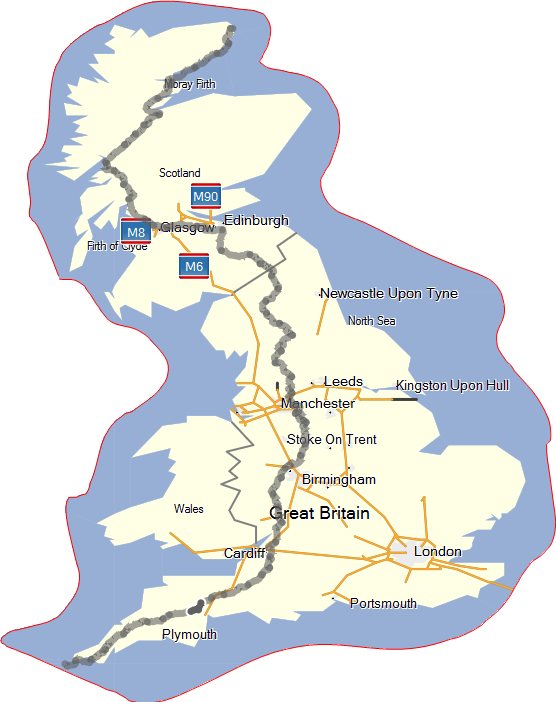
What Route to Take
In the previous "General Considerations" post I weighed the pros and cons of LEJOG vs JOGLE. There are many permitations of what overall route to take, for example, some people choose to do the entire journey by the shortest possible route, sticking to A roads. This for me sounds like hell and I would need to question the reason for undertaking the journey in the first place if all I was going to see was a constant stream of heavy traffic. Some of the main route planning questions I asked myself when planning the route were as follows:- Should I make use of long distance footpaths like the Pennine Way, Great Glen Way, Cotswold Way etc. or stick to footpaths and bridleways, quiet roads and Sustrans routes?
- Should I divert around the busy A9 & A99 in Scotland, adding an extra day to the journey?
- Should I follow guide book routes or published GPS trails of others that have completed the walk?
- How many miles should I cover in a day?
(I have decided to have a daily target of 25 miles, this will cover the 1,100 miles in 44 days).
Route Planning
So where do you start when trying to plan such a long route? Well, the answer is that there is enough information available to mean that you do not need to scrutinise OS maps and work out a detailed route yourself. Instead, you can check out some of the published routes of people who have done this before. Some of the books that almost everyone undertaking this challenge seem to come across are as follows:- The Land's End to John O'Groats Walk by Andrew McCloy ISBN-10: 1871890594
- The End to End Trail by Andy Robinson ISBN-10: 1852845120
- John O'Groats to Land's End: The Official Challenge Guide by Brian Smailes ISBN-10: 1903568188
The most useful resources that I found when researching the route were blogs and published GPX tracks from people who had completed the journey. I managed to find a complete published track across the country which I used as the basis of my route. It was still necessary to reverse the route for each day, tidy up any diversions, waymark campsites etc. but having the entire route essentially in place was invaluable. I shall include my own route for download if and when I complete it successfully.
Websites that proved incredibly useful when planning this trip were the following:
No comments:
Post a Comment